The Dent County Historical Society is hosting a Civil War program on the 160th anniversary of the Skirmish at Ashley at 2 p.m. on Aug. 28 at the James & Gahr Fellowship Hall in downtown Salem.
Kent Nichols plans to show his documentary movie: "Civil War in the Ozarks: Battle for Dent County," created for the sesquicentennial of the Civil War. Kent is a descendant of the Susie Nichols family who resided on the Current River.
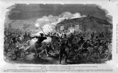
Dent County was an active area during the Civil War. The Battle of Salem and the Battle of Springer's Mill were right here and troop movements were all over Dent County early in the war.
It is a remembrance ceremony for both the Skirmish of Ashley and the Skirmish of Inman Hollow in southwest Dent County.
Each skirmish took place within four miles of what was then the Stephenson Mill, located in what became Montauk State Park at the headwaters of the Current River and next to the beginning of the National Park Service Ozark National Scenic Riverways.
Stephenson Mill was situated about halfway between each skirmish and is referenced in Civil War histories as Stephenson's Mill and North Stephenson's Mill on the Current River.
The present-day 1895 Montauk Mill replaced the Stephenson Mill that had burned.
This site is different from Montauk Springs, located north of Salem, and is one of three sites recorded. Birch Pond and Pleasant Valley are the other two and are in the original Missouri Land Survey Map of Dent County.
The Skirmish at Inman Hollow took place about four miles east of Montauk State Park, where the Union troops left what is now Hwy. YY, near what was the Upper Parker #68 Elementary School.
My great-great-great uncle Nathanial Stephenson owned a mill that was located in what became Montauk, as well as a post office (a place recorded on my mother, Eula Wofford's birth certificate, who was born four miles west). Dad, Lorse Gray, and I were born four miles east of the mill, also in Current Township, within a mile of the Skirmish of Inman Hollow.
Mount Olive Baptist Church on Hwy. VV near the Texas County line is four miles west of Montauk and about a mile northeast of Ashley Creek and Ashley Cave. It is locally known as the Saltpeter Cave.
William Ashley had the Saltpeter hauled out of the cave by pack mules to his ammunition plant in the Potosi to make gunpowder for the War of 1912. The William Ashley Story stays alive here in Dent County with Ashley Cave and Ashley Creek, a tributary of the Current River, still keeping his name.
When Missouri became a state in 1820, William Ashley became Missouri's first lieutenant governor. Ashley was the surveyor for Dent County and Ashley County. Ashley County was changed to Texas County, the largest county of Missouri's 114 Counties.
Ashley Cave is located on private property.
Henry Rowe Schoolcraft traveled to these sites on his way to record the Flora and Faune at the Salt Peter Cave in 1818, on his way to Arkansas, and in 1819 he went back up to Potosi from which he came.
For more information about the Civil War program, contact Deloris Gray, President County Historical Society, at 573 729-2545 or Jon Logan, VP of the Society, at 816-541-0328.