

Salem is not only Missouri’s gateway to the Ozarks’ scenic riverways but is also the perfect jumping off point for those looking to enjoy the state’s best wildness trails. Whether an afternoon, day or weekend trip hikers will find 10 incredible opportunities for local natural adventures.
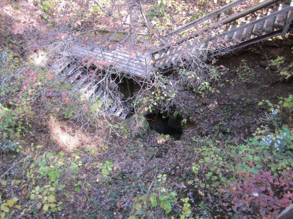
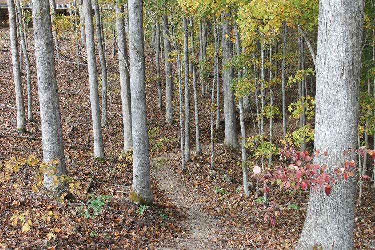
The Devil's Well Trail takes hikers from the depths North America's largest underground lake to the heights overlooking the Current River. Along the way, the trek goes through caves, glades and hollows of oak, pine and cedar forests.
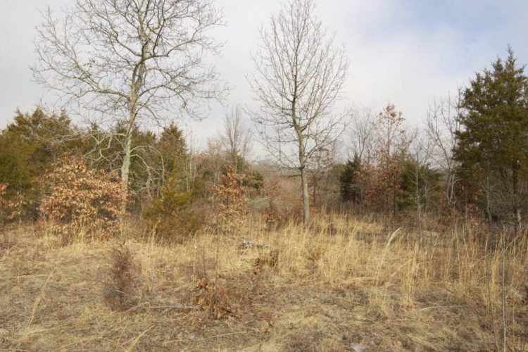
1. The Devil’s Well –The Devil’s Well trail is located off of Highway KK in Shannon County and exists on land owned by Pioneer Forest and the Ozark National Scenic Riverways. This 4.6-mile loop tops the list as if offers the most diverse sights and settings of any other trail in the area. The moderately difficult trek starts by the Devil’s Well and includes a descending spiral staircase from which the one can look down to the largest underground lake in North America. From there hikers climb hills and hollows through stands of oaks, pines and cedar trees. You can also expect to traverse through glades, along rocky ridges and to the top of one of the best overlooks of the Current River. The trail network further includes a breathtaking spur down to Cave Spring which is flanked by towering sycamores and giant boulders from long collapsed bluff faces. The hike offers the best bang for your buck in terms of time investment, but the site is isolated from facilities or stores – so prepare what you’ll need in advance.
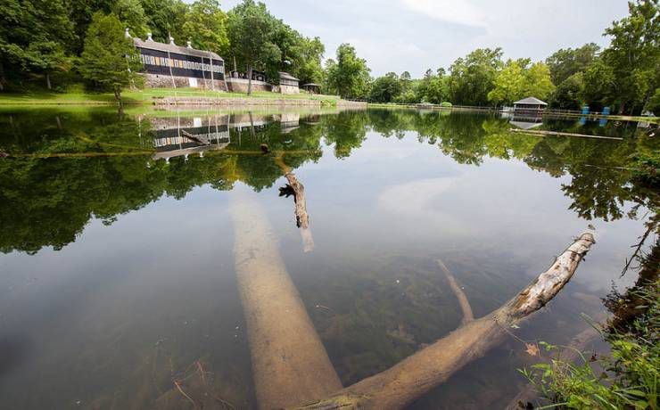
After the recent development of several hiking trails, Current River State Park has emerged as one of the premier destinations for those looking for an outdoor adventure.
2. Current River State Park – Pack a lunch as Current River State Park offers one of the densest concentrations of short and long hike trails in the region. A total of three moderately difficult trails are located within the park including the 2.6-mile Ninebark, the four-mile Jones Hollow and 1.4-mile Centennial Bluff trails. The 5.25-mile Current River Trail also connects the park to the nearby Echo Bluff State Park. Ninebark takes hikers through an old tree farm, circles a nearby hill top and brings you back to the trailhead next to the Current River. The Jones Hollow Trail spans through the epic forests and glades in the northern end of the park. The Centennial Bluff is the parks quickest trot, beginning and ending behind the park’s iconic lodge building. Current River State Park is located off Highway 19 about 25 miles south of Salem.

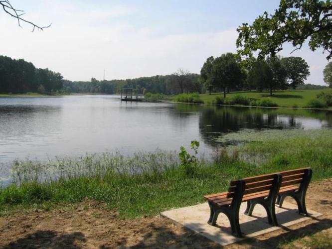
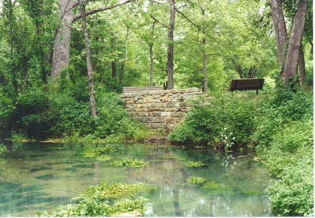
Lake Ziske and Lake Turner offer one of the most meditative venues to enjoy what makes the Ozarks such a unique place in the world.
3. Shawnee Mac Lakes Conservation Area – The hometown favorite of Salemites offers a peaceful afternoon for those looking for some convenient exercise or quality time with nature. The main trail is an easily hiked 2.5 mile figure-eight loop around the area’s Lake Ziske and Lake Turner. An outer path by Lake Turner also offers a forested path. Wildlife lovers will find the many critters in and around the lakes particularly enjoyable. Geese, ducks and other waterfowl are popular mainstays. Those with a keen eye may also spot turtles, muskrats and other lake dwellers. The trails offer one of the best venues to enjoy viewing the Ozarks wildlife in a safe and comfortable environment. The Shawnee Mac Lakes Conservation Area is located off County Road 4110 four miles east of Salem.

Echo Bluff State Park is quickly becoming synonymous with wilderness luxury, however, the site is home to the same beautiful displays of nature which made Camp Zoe a destination for decades.
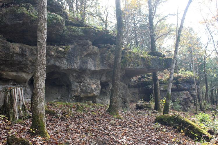
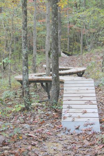
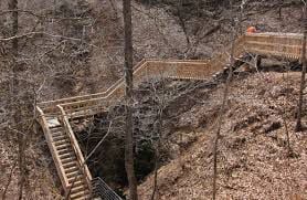
4. Echo Bluff State Park – If you’re looking to get your feet dirty while being within close proximity to luxurious comfort this may be the destination for you. The park has two trails open now including the 3.25-mile Painter Ridge Trail and 5.25-mile Current River Trail. Two more trails are also currently under development including the Sugar Tree Hollow Trail, which will enter into the next door Pioneer Forest, and a southward trail to Round Spring. Painter Ridge is a mostly easy hike which circles the park along its surrounding ridges. Epic rock formations dot the path as well as several ramps and challenge elements for those bringing mountain bikes. The long haul Current River Trail offers a rugged Ozarks styled endurance test. The all day hike offers everything this region is famous for, from hills to hollows and everything in-between. For those willing to take the challenge, be sure to have a vehicle waiting at next door Current River State Park to shuttle you back to Echo Bluff once finished. Echo Bluff State Park is located off Highway 19 about 30 miles south of Salem.

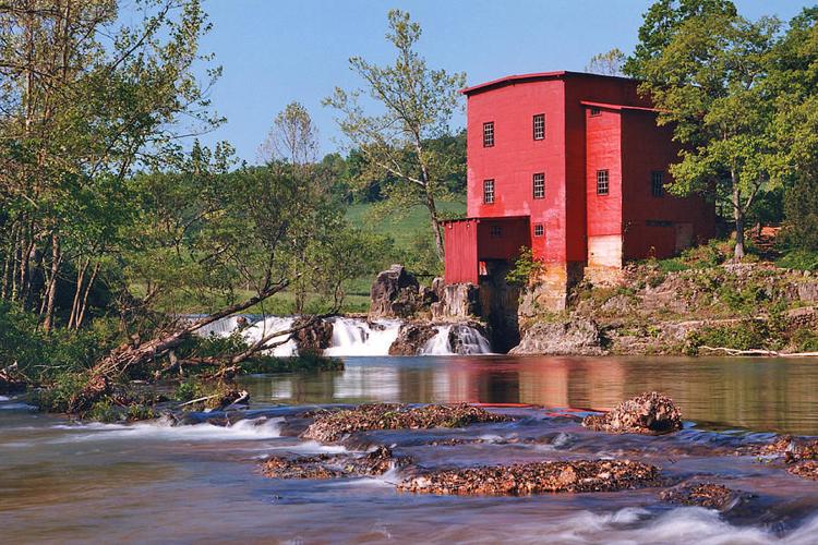
Bring a pair of waders if your looking to hike at Dillard Mill, because the trail head is on the other side of Huzzah Creek, which must be forded to gain entry.
5. Dillard Mill State Historic Site – The ornate beauty of Dillard Mill is juxtaposed by the gritty toil of what is undoubtedly this region’s most difficult trail. Although seemingly short on paper, the rugged 1.5-mile Mill View Trail is not for beginners and those taking on the challenge should prepare for a long nap after its completion. The trail begins with hikers having to ford the waters of the Huzzah Creek to reach the trailhead across from the mill. From there is a climb straight up hundreds of feet along a steep grade to the top of the mill’s overlooking hill. The path then winds up and down the ridges in a circle back to the initial starting point. The reward of the hilltop view is worth the effort, but be prepared for exhaustion and blisters. This opportunity is great for serious hikers, those looking to burn calories or hikers hoping to tighten their behinds. The Dillard Mill State Historic Site is located on property owned by the L-A-D Foundation off Highway 49 about 40 miles east of Salem.
Lane Spring offers both views from the river bottoms of the Little Piney to the top of the rock outcroppings overlooking the surrounding valley.
6. Lane Spring Recreation Area – Some of the best views of the Ozarks can be found from the rocky outcropping above Lane Springs. Two moderately difficult trails are available including the 1.25-mile Blossom Rock Trail and the 1.5-mile Cedar Bluff Trail. Both paths start in the verdant bottomland of the nearby Little Piney River. Hikers then climb the ridges of the sites surrounding hills from which the underlying river and valley offer an epic vista. The hillside ridges also have many rock outcroppings at their tops which present the perfect opportunity for a highland picnic. The Lane Spring Recreation Area is located about 25 miles west of Salem off Highway 63 on land under the management of the Mark Twain National Forest.
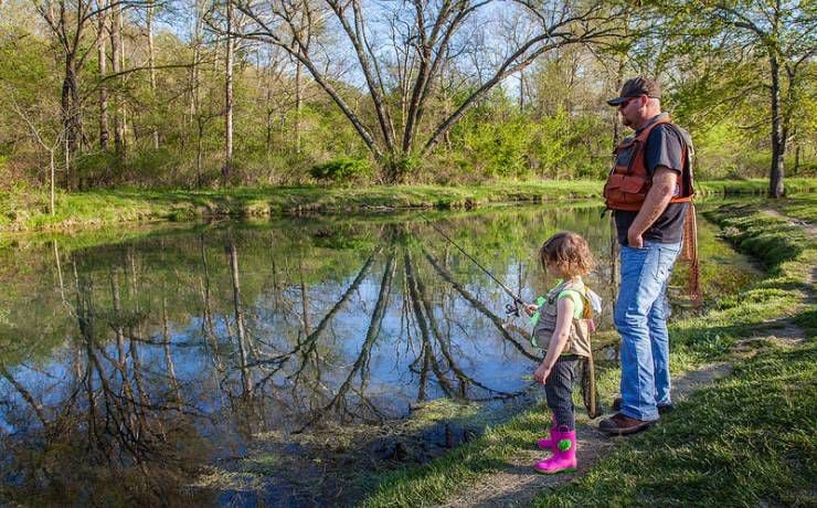
Although more well-known for fishing, Montauk offer easy access for those looking to enjoy a hike in nature. The paved trail around Montauk Spring is perfect for those pushing a baby-stroller or those with limited mobility.
7. Montauk State Park – Montauk is famous across the Midwest for its fishing but the park also offers a couple of quality hiking adventures. The park’s premier hike is the 1.5-mile Pine Ridge Trail which traverses through the 25-acre Montauk Upland Forest Natural Area. The path offers some great views and walks through stands of short-leaf pine and oak. For a more easily hiked expedition, try the mile-long Montauk Lake Trail around the park’s namesake. This path is mostly paved and winds around the trout hatchery and headwaters of the Current River. If wheels are involved in your adventure, be that wheelchairs to strollers, the Montauk Lake Trail provides perhaps the best vantage to accessibly enjoy the nature of the Ozarks. Montauk State Park is located off Highway 32 about 21 miles southwest of Salem.
White River Trace Conservation Area is one of two publicly accessible locations where the original route of the Trail of Tears can be hiked.
8. The Trail of Tears – The Trail of Tears is famous nationwide as the path of the Cherokee Nation’s forced march west from 1838 to 1839. The Hildebrand Route of the march entered Dent County’s northeast corner and cuts through to the county to the west. The course of the original trail is today blocked by highways and fenced off private property; however, two publically accessible segments can be hiked for a make your own adventure experience. One segment of the Trail of Tears is marked through the 13,500-acre Indian Trail State Forest off Highway 19, about 20 miles north of Salem. This hike will mostly be along the forest’s gravel roads in the shadows of its trees. Look for white signs marking the original route of the Cherokees. A second prairie segment is also available at the White River Trace Conservation Area 13 miles west of Salem off Highway H. This opportunity also offers no official foot trails, but a well-beaten truck route offers an enjoyable hike through tall grasses and wildflowers. Please note both sites are open to hunters and caution should be exercised during open seasons.

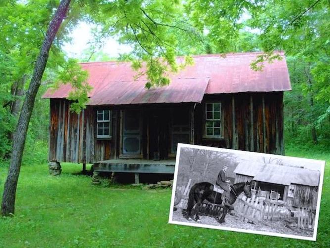
Susie Nichols was a Dent County homesteader famous for rejecting modern conveniences and instead staying true to the pioneer lifestyle well into the 20th Century. Her cabin and surrounding farm are today preserved by the National Park Service.
9. The Susie Nichols’ Cabin – Take a trip back in time to the Susie Nichols Cabin historical site located in the Ozark National Scenic Riverways. Be prepared for a long hike. Although dated maps and description online state you’ll be able to drive up to the trailhead from the east on County Road 6520, the road is in reality impassible even with a four-wheel drive. Your best bet is to park at Cedar Grove and hoof it west along the roadway for a couple miles to the trailhead. From there you can expect another half-mile north to the cabin. Once there you’ll have a one-of-a-kind tour through Nichols preserved cabin, barn and homestead site. If you still have the energy, paths going north to Schafer Spring can also be enjoyed. The Susie Nichols Cabin trail is very popular with horseback riders, so beware of riders and droppings. Although a unique treasure, the trail’s difficult access prevents it from being a more well-known hiking destination.

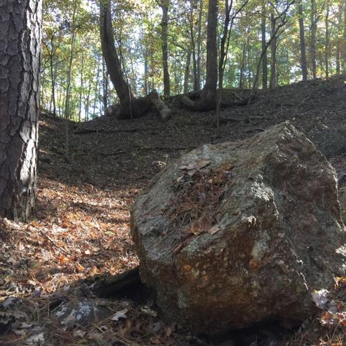
Boulders of soft red hematite iron ore can still be found at the bottom of the old abandoned Nova Scotia Iron Mine.
10. Little Scotia Campground – You may need a guide to fully appreciate the hiking opportunity present around Little Scotia Pond. The site today is an abandoned campground of the US Forest Service accessible off Highway 72 about 16 miles southeast of Salem. A short trail does circle most of the site’s pond, however, the true adventure is along the abandoned roads of Nova Scotia, an iron mining ghost town abandoned in 1886. Nova Scotia’s main roads are still present and can be followed to the town’s old cemetery, mine and blast furnace site. However, none of these routes are marked so you’ll need to take someone experienced with the area to likely find these locations – or otherwise risk getting lost in the isolated forest. There are also open cistern holes present creating another potential hazard. For hikers looking for a more clearly marked path in the Mark Twain National Forest, try the two-mile trail around the Huzzah Ponds located 16 miles east of Salem off Highway 32.


